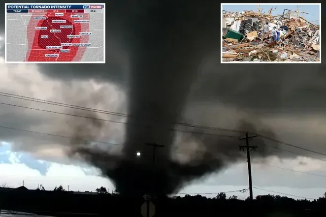
Over 60 million people in the US Midwest and South are at risk of severe weather, with the potential for strong tornadoes on April 27, 2026, according to FOX Weather forecasts.
The Storm Prediction Center has issued a Level 4 out of 5 warning for southeastern Missouri and southwestern Illinois, where atmospheric conditions are becoming particularly unstable, potentially forming strong EF-3 or higher tornadoes.
High-risk cities include St. Louis, Cape Girardeau, Rolla, and Poplar Bluff (Missouri), along with Mount Vernon (Illinois).
The danger zone stretches from southern Minnesota down to Southern states like Arkansas, northern Mississippi, and northern Alabama.
Forecasts indicate strong thunderstorms will form after 2 PM and last until about 10 PM. Large hail, wind gusts over 60–70 mph, and the risk of destructive tornadoes have been noted in areas like Kansas City and St. Louis.
Cumulative rainfall of 3 to 5 inches is expected to cause localized flooding in parts of Kansas and Missouri, increasing the risk of flash floods in several states in the coming days.
This dangerous weather event follows a series of extremes that began last week, including the violent tornado in Oklahoma and tornadoes in Texas that left at least two people dead.
Beyond the high-risk zone, a Level 2 area also covers several major cities that have previously seen destructive tornadoes in Illinois and Indiana, such as Chicago, Indianapolis, Memphis, and Nashville.
By April 28, 2026, the storm system is expected to move eastward, affecting the Mississippi Valley as the Southern US faces strong storms with threats of large hail, damaging winds, and further tornado potential.
Officials advise residents to closely monitor weather alerts, prepare shelter plans, and limit travel during dangerous hours.