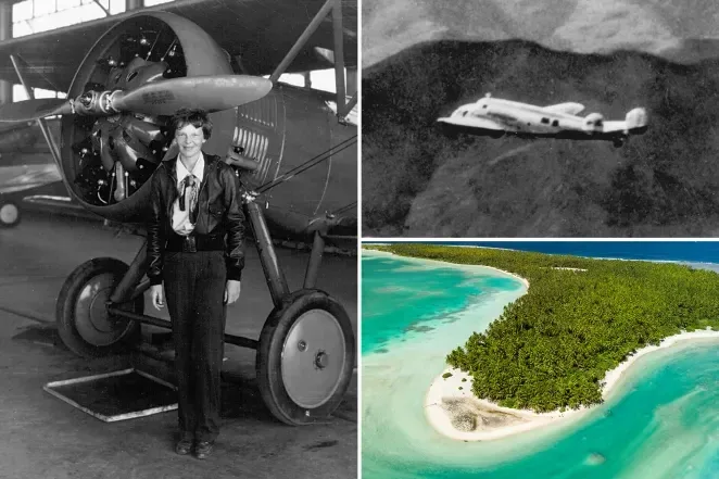
The nearly 90-year mystery of Amelia Earhart has suddenly resurfaced after veteran pilot Justin Myers claimed to have discovered traces of the missing aircraft on Nikumaroro Island using Google Earth imagery.
Myers, with nearly 25 years of flying experience, became interested in the 1937 disappearance after watching a documentary about the failed around-the-world journey of Earhart and navigator Fred Noonan.
Based on his personal experience, he hypothesized an emergency landing location in a fuel-exhaustion scenario in the middle of the Pacific Ocean.
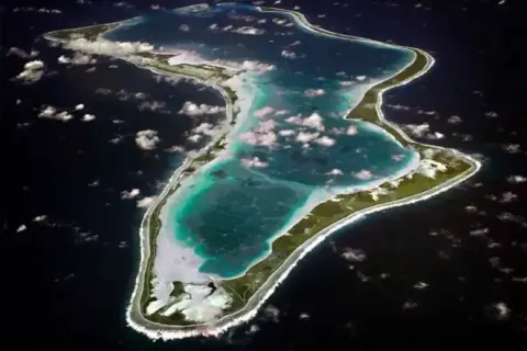
During his satellite imagery analysis, Myers discovered a flat area on Nikumaroro Island—a location long suspected to be linked to the disappearance.
A dark object approximately 39 feet long appeared there, matching the dimensions of Earhart’s Lockheed 10-E Electra aircraft.
Myers continued to scrutinize details and believes there are additional traces such as engine parts and debris surrounding the area.
He noted the imagery fits the characteristics of a vintage twin-engine aircraft about 12 meters long.
However, Myers admitted he cannot confirm with certainty that it is Amelia Earhart's plane.
Nikumaroro is located in Kiribati, between Hawaii and Fiji, and has long been considered a point of interest in many theories about Earhart’s final landing site.
Last year, researchers from Purdue University also published 1938 imagery showing an unusual object under a lagoon on this island, fueling further theories about the plane wreckage.
A research team of 15 people is scheduled to visit the island to verify, but the plan has been postponed to 2026.
The mystery of Amelia Earhart and the 1937 flight remains one of the biggest questions in global aviation history.