Updated April 9, 2026 – 9:29 PM (New York time)
The El Niño phenomenon is showing signs of returning with a 61% probability between May and July, according to a forecast from the National Weather Service – Climate Prediction Center.
Scientists estimate a 25% chance that this system will develop into a “very strong” El Niño event, prompting closer monitoring of global climate fluctuations.
This development comes immediately after the end of La Niña, marking a transition phase in the ENSO climate cycle—a system that oscillates between warm (El Niño) and cold (La Niña) phases.
El Niño forms when trade winds weaken, causing warm water to accumulate abnormally in the central and eastern Pacific Ocean.
This phenomenon often has wide-ranging impacts on global weather, leading millions to face prolonged heavy rain and the risk of severe flash floods. In California, El Niño typically increases the likelihood of a wet winter, sometimes leading to dire situations such as the rescue of homeless individuals in Los Angeles from floodwaters, though actual results can vary.
Historical data shows that since 1950, only a few strong and very strong El Niño events have been recorded. In some cases, despite high intensity, they did not bring as much rainfall as expected.
Experts note that the current system has a larger volume of warm water than in previous periods, coupled with strong westerly wind signals and strong thunderstorms appearing over the weekend, increasing the likelihood of development.
Despite this, scientists emphasize that it is too early to provide specific forecasts for the upcoming winter.
World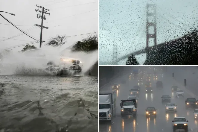

61% Chance of El Niño Forming, Risk of Very Strong Climate Event
El Niño has a 61% chance of forming between May and July, with a 25% risk of becoming a
Trương Atlanta
·
Support Truong Atlanta
If you find these articles helpful, buying me a coffee helps keep the news coming every day for the Vietnamese community.